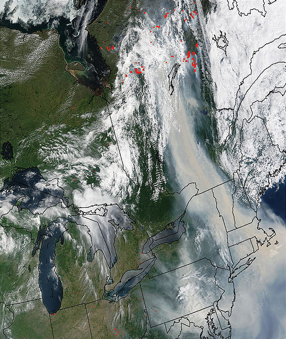
A MODIS satellite image of smoke from forest fires shows both the intensity (red is the area of densest smoke) and spread of smoke from Canadian fires to New England and the Mid-Atlantic States. Photo courtesy of Yorum Kaufman, NASA GSFC
A MODIS satellite image of smoke from forest fires shows both the intensity (red is the area of densest smoke) and spread of smoke from Canadian fires to New England and the Mid-Atlantic States. Photo courtesy of Yorum Kaufman, NASA GSFC